


birchy
-
Posts
3,042 -
Joined
-
Last visited
Content Type
Profiles
Forums
Events
Store
Everything posted by birchy
-

How Do You Store Your Rod Tubes?!
birchy replied to ÜberFly's topic in On The Water - Fishing Related
Yeah, not long enough for a 2 piece. My one 2 piece is in the back corner of my closet. All the rest are 4 pieces and fit in there with room to spare. -
How Do You Store Your Rod Tubes?!
birchy replied to ÜberFly's topic in On The Water - Fishing Related
In a plastic bin like this, under the bed: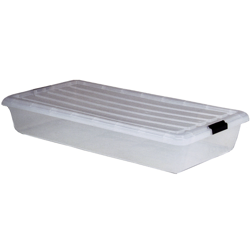
-
The "Porta-Bote" meets all your criteria.. except for cost, which is probably the most important one.
-
I'm thinking of trying the Fishpond backpack/vest combo next time around. I think I was looking at the Shooting Star.. but I just checked the website and now they have the "Tundra" and "Piney Creek" for 2011.
-
A few bad apples...
-
Official Flames 2008/2043 Seasons Thread
birchy replied to SanJuanWorm's topic in Off The Water - Not Fishing Related
Also, I hope Ivanans is okay! That was brutal. Seriously.. fighting is part of hockey, but you never like to see a guy get really hurt like that. -
Official Oilers 2008/2048 Season Thread
birchy replied to darrinhurst's topic in Off The Water - Not Fishing Related
Eberle's first NHL goal was awesome! This kid is clutch. They asked Taylor Hall about if afterward and he's like "it was sick!" haha. The kids played great! -
MMmmm... bully burgers!
-
Does anyone know if there's any public access points right around the Highwood/Sheep confluence? Feel free to PM me if you'd prefer. Looking at Google Maps, I'm looking at taking Highway 552 east (then south), and then Range Road 283 south, and then possibly Township Road 210 east. Either that, or continuing south on Highway 2, turning east on 547, the immediately north and east onto Township Road 202b, then north on Range Road 285. Only thing is it's hard to tell on Google Maps sometimes which roads are public and which are private. And it looks like there's a heck of a lot of farmhouses down there.
-
Fun-eeeee-guy!
-
Khabibulan is another option for me too, actually... will he have a bounce back year? Or will he get hurt again? As an Oilers fan, I kinda want to take him.. but last year makes me uneasy. Most figure that the Oilers won't be that much better this year than last.. but at least will be exciting to watch. But will they be worse than Atlanta or Florida?! Decisions, decisions...
-
Official Oilers 2008/2048 Season Thread
birchy replied to darrinhurst's topic in Off The Water - Not Fishing Related
He has a reputation of being a cancer in the locker room.. they don't want him around the young guys on the farm team. Smart move IMO! PS - how are the Flames draft picks looking? -
Official Oilers 2008/2048 Season Thread
birchy replied to darrinhurst's topic in Off The Water - Not Fishing Related
Souray just got shipped to Hershey. Awesome. One of the comments under the TSN article was "Take that Souray's ego!" -
All good points.. but it's Chris Mason, not Steve. Someone else already has Steve Mason. Biggest difference from last years stats is that Chris Mason is playing for Atlanta this year, not St. Louis. I think the Thrashers are a bit better than the Panthers.. but not much.
-
Anyone else playing in any hockey pools this year? I'm playing in a "Just for Fun" league on Yahoo Sports with a few of my buddies. I'm trying to decide on a couple of roster moves.. but I'm torn. Would love some feedback from a few of you hockey guys! I had written out a big long explanation of my thought process.. then I thought, I don't want to lead people in the wrong direction. So I'll just do it with a poll. Who would you pick? Brian Campbell or Bryan McCabe (keeping in mind Campbell is expected to be out for the first ~3 weeks)? Tomas Vokoun or Chris Mason?
-
Absolutely stunning pics Frank!! Thank you so much for sharing. Many of us will never get to go to these types of places, so it's awesome to be there vicariously!!
-
No. So no..
-
Nope! ..... He doesn't cheer for the Blackhawks..
-
Awesome.
-
"poacher"+ Fireball+classicrewind= Static Free Fishing
birchy replied to bigbowtrout's topic in Photo Posts
Great pics guys!! Thanks for sharing. -
I seem to recall my wife mentioning to me that some friends of ours here in Calgary recently had a problem with bed bugs. I guess the kids beds both had them and they ended up throwing out the beds completely and replacing everything.
-
Does That Sandwhich Smell Funny To You?
birchy replied to reevesr1's topic in On The Water - Fishing Related
This trip sounds like the making of great "camping stories" for years to come. Jealous! -
Exactly. And the fact that there's a dude taking a deuce on the front of the magazine I'm reading.. JMO. For those of you who've been down to these locations... please excuse my naivety. Is this a real outhouse? And if so, please tell me there's some sort of container underneath and the waste isn't going directly into the water..??
-
Woohoo!! A good start to an awesome vacation!
-
Although I haven't seen it with my own eyes, from what I've heard, it happens here too all the time!