

trailhead
-
Posts
1,814 -
Joined
-
Last visited
-
Days Won
68
Content Type
Profiles
Forums
Events
Store
Posts posted by trailhead
-
-
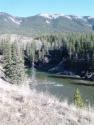
I tend to spend time along both rivers in Calgary and recently came upon a group of younger people wading down the Elbow. Turns out they were doing a brown trout redd count and I engaged with them and found out that they had not seen many in the stretch they were wading. I know the stretch and personally have not come across many fish there in the past. Then a few days later I was walking by the Bow and had seen redds on that stretch in the past and also observed fish on them. So I stopped to look and saw four big redds and counted 18 fish over top. That is the most I have ever seen in that spot. Nature is truly mysterious and I believe we have a limited understanding of all the factors in play.
-
 1
1
-
-
Thanks for all you have offered over the years and all the best in your future endeavours. A bad day fishing is better than staying at home.
-
 1
1
-
-
It can be quite frustrating at times, and then I have used it and was slicker than ... through a goose
-
I think common sense is the best action in this case. I went out to a foothills stream, beforehand I checked water level and when I got there took the temperature. The level was in the normal range for this time of year and the temp was 55 F. So caught plenty of feisty fish. When I shut it down at 1:45 the water temp was 60 F. A couple of years ago I tried to fish a different stream. When I got there the level was really low and the water temp was 70F. I did not fish and as I was leaving saw a small trout float by belly up, maybe someone fishing upstream.
-
2
-
-
I was camping down south and they had just put in a fire ban. The conservation officers came by a couple of days later. I spoke to onw of them and she told me that when there are closures of any kind imposed that there is a grace period that they use discretionally. Probably for people like the older gentleman mentioned.
-
1
-
1
-
-
Snowpack this winter was variable on location. North Bow drainage was low but the Castle was above average. Biggest impact was the 30 degree temps in May just melted so quickly. I was up on the Highwood and the water temp was 40F and the level was what you see mid summer. However there is now huge rain happening in the Oldman and Castle drainages so I guess we will see what happens. Pray for rain.
-
Bow River at the confluence with the Elbow 58 F at 11:30
-
1
-
-
Fished the Bow today and the Trico's were swarming but nothing was rising. water temp at Fish Creek was 56 F
-
2
-
-
I was fishing the upper Elbow today and the water temp was 54 F at noon
-
1
-
-
I have a buddy that does that, he thinks it's okay because he fishes the hole up and down repeatedly. I have tried to convince him that it is selfish and that you don't get to experience the whole stream. But he says that others can pass by and fish the other holes.
-
A buddy of mine hooked a grebe on a leech pattern once. We landed it and got the hook out. It gave us s#*t as it swam away. The weirdest thing was the stock from a sawed off shotgun I found floating by Fish Ck.
-
If strike indicators are banned, then so should streamers aka lip rippers
-
Well another statistical analysis thrown in our faces. The interesting thing about the graph is that it is blank for the time period centered on the flood in 2013, and the last two data points indicate an upward trend. Then I wonder about the historical 4 km stretch, all my historical stretches where I had my best catch rates prior to 2013 are completely changed, with no holding water. I used to fish around an island that had 4 good holes above, in the middle and below it. There isn't an island anymore and all the holes are gone. Since the flood fishing the Bow for me has been terrible. But last Tuesday I tried a stretch I have never fished before and came upon a pod of rising fish, caught 9 and hooked and lost about the same amount all were rainbows. Not big but by my estimate they were all healthy post flood fish, and to my un-biologist eye none of them had any hook marks, other than from my size 12 hook. The thing about statistical analysis is the word anal is in it, and I don't know if you heard about the statistician who drowned wading the river where it averaged 3 feet deep.
-
1
-
-
Yeah I saw that too. Probably put up there by some hipster doofus.
-
TU has it posted, don't know if that counts as a fly fishing website.
-
There is a huge issue about that this year in the Bighorn, in past years it was terrible in the Livingstone. I recall hearing about someone who rigged up a toilet seat on a tree leaning over the Oldman River. In the same time period I was fishing the area after the Labor Day weekend and came upon a pile of human excrement about 2 feet high that was obviously the s*#t pit for the summer for whoever used as their 3 month spot. The crowd that behaves this way seems to move wherever they think they can get away with that type of behaviour. Some people should be punished for raising kids with no sense of responsibility.
-
1
-
-
I read somewhere that whites are more susceptible than trout, primarily because they tend to be more of a bottom feeding fish and are more exposed.
-
I caught a whitefish that was infected with whirling disease in the Bow, in 1994.
-
1
-
-
Saw a couple in the Elbow in the Roxboro neighborhood two weeks ago. they were both dead.
-
Thanks guys that was my feeling but I wanted confirmation.
-
So I am looking at taking a buddy fishing and was thinking of doing about 8 km of walking and wading on a small river in the foothills. Is that too far to take a new flyfisher and is it doable in a day?
-
2 hours ago, DonAndersen said:
Grassy Mountain was an underground mine for many years. It had its own town called Lille. Both are gone now.
Grassy Mtn. history is mirrored by the open pit mine NW of Sparwood which was an underground operation supporting The towns of Michel and Natal.
History is important - let’s get it right.
Don
Actually Lille was operated from only 1901 to 1912 by the West Canadian Colleries producing coking coal, which is why the old coking ovens are still there located north of Frank. The Green Mountain mine operated from 1909 to 1953 and initially was a underground mine but was converted to an open pit mine by Scurry Rainbow, who gave up on the project and eventually were bought by Devon Canada. Who then sold the rights to Benga Mining aka Riversdale Resources. This operation is located north of Blairmore, no where near Lille. I have hiked to both locations as I lived in the Pass for 15 years. Yep get it right!
-
1
-
-
The Grassy Mountain project started in 1909 and the public consultation will be held this October. Let me see 9 carry the one that's 111 years to get to this point. If Atrum takes as long that means the project will be this point;
In the year 2131,
will there even be a sun,
will the UCP run,
as a political par-ar-ar-tee
-
 1
1
-
-
Well if this mine takes as long to move along as the Grassy Mtn one just north of Blairmore there will be plenty of time for it to get killed. The Grassy Mtn one is only just now going to public consultation. By the time that the Atrum one gets further along Kenney will be drummed out of office and the NDP will kill the project. Jason Nixon is a simplistic stooge of Kenney's and we could write a million letters to him and get not one inch closer to having this shutdown. So pick your spot.
-
2
-
Wet wading
in General Chat - Fly Fishing Related
Posted
Just wondering if water temps are still warm enough for wet wading. Was out of the country for the last while and don't know if I should break out the waders or not.